Paths

Livigno Giro delle Tee

circle Closed
Mountain-bike E-Bike

Period
JUN - OCT

Length
18 Km 8 m

Duration
01:44

Difficulty
square square square

Livigno Giro delle Tee
Path detail

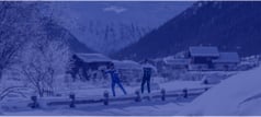
We start climbing on the only hard hill ahead, following the sign of the Way n. 190 just on the left before the Ponte Calcheira 1846 m for the whole first part of the route. We arrive at the Tea da Taglieda 1980 m and meet the first diversion towards the long Dosso della Blesaccia sign Way n. 162. Dirt roads and single trails alternate with each other and take us to the Tea dal Plan 2000 m, then to the Tea da Rin 2005 m, and finally to the Tea dal Pel 2000 m. The uphill trails to Plan da la Montanela start from these two last mountain huts sign Way n. 161 and Way n. 160. The tough dirt road sign Way n. 157 climbing up to Carosello 3000 skiruns goes past Tea dal Pel too. Continuing on the route n. 190, we meet the Ristoro Tea da Borch, and then descend on the amusing trail towards the car park 14 of the Ponte Lungo 1875 m. During the climb on the opposite slopes we always follow the Way n. 100, which often runs deep into the forests. We go past the beautiful Tea da li Tea 1920 m, the funfair Larix Park, and then through the hamlet of Teola. From here on all downhill to the lake, after going past Tea di Pemont, Tea di Desgiana and Tea del Brun. The cycling path running on the shores of the lake takes us to Ponte Calcheira again.

Details

Start
Start
Parcheggio Pont de la Calcheira

End
End
Parcheggio Pont de la Calcheira

Max. slope inclination
14%

Min. slope inclination
26%

Altitude difference
Altitude difference
469 m

Altitude difference
Altitude difference
470 m

Max altitude
Max altitude
2031 m

Min altitude
Min altitude
1806 m

Other paths

Mountain Bike

Trekking excursion Mountain-bike

Rifugio da Casciana

circle Closed
From the Calche'ira Bridge P3 take path N167 along the lefthand side of the Fedari'a stream: the path is fully restored and easy to walk. A short distance later you reach a green open space, Lule'ta, ideal for picnics and barbecues. The path continues through forest scenery on the lefthand side of ...
Length
6 Km 260 m
Duration
00:46
Difficulty
Trekking excursion E-Bike Mountain-bike

Bocheta de Trela

circle Closed
Start from parking area P12 Pont de Rez in Trepalle and then take the western slope: the trail takes you to the bridge connecting the houses of Campacc to Arne'ira. From here path N129 goes gently uphill through a beautiful forest of mountain pines to Tee de Pila. This stretch offers fine views of ...
Length
5 Km 215 m
Duration
01:38
Difficulty
Trekking excursion Mountain-bike

Baitel dal Moton da lAl

circle Closed
Start from parking area P6 La Tresge'nda: the first stretch is a paved bridleway up to Pont da l'Al. From here there is a dirt bridleway, path N119, that winds up through a forest of larch and fir trees, with numerous plant species described by information panels along the trail. The forest gives ...
Length
3 Km 739 m
Duration
00:27
Difficulty
Trekking excursion Mountain-bike

Bocheta de Valecia

circle Closed
Start from parking area P12 Pont de Re'z. Follow the Valecia Valley on a dirt bridleway a short distance to the Bait de Vale'cia. Continuing you soon reach the Chese'ira de Vale'cia then continue on the footpath. The first part is easy, flanked by gently sloping pastures. At the foot of La Fo'pa, ...
Length
7 Km 202 m
Duration
00:52
Difficulty
Trekking excursion Mountain-bike E-Bike
Length
15 Km 759 m
Duration
04:14
Difficulty
Trekking excursion Mountain-bike Joëlette E-Bike

Valle Alpisella

circle Closed
The tour starts from the parking area near the Church of San Giacomo di Fraele at Cancano in Valdidentro inquire about accessing the Cancano Lakes by car. Continue along path N199 until the mouth of the Val Alpisella. Here, on the right, starts bridleway N138 which winds through the forest. There ...
Length
5 Km 364 m
Duration
01:41
Difficulty
Trekking excursion Mountain-bike

Ristoro Carosello 3000

circle Closed
From the Calche'ira Bridge P3 take path N167 along the left-hand side of the Fedari'a stream: the path is fully restored and easy to walk. A short distance later you reach a green open space, Lule'ta, ideal for picnics and barbecues. The path continues through forest scenery on the left-hand side ...
Length
9 Km 629 m
Duration
01:11
Difficulty
Trekking excursion Mountain-bike Walk E-Bike

La ciclabile

circle Closed
Take the path from parking area P7 Chese'ira da Campac and immediately cross the bridge over the stream of Val dal Mont: the dirt bridleway descends slightly via Te'a da li Sc'teblina to Campacio'l da sora. It then becomes a paved cycle way to parking area P4 Latteria Dairy that runs along the Spol ...
Length
10 Km 448 m
Duration
00:42
Difficulty
Mountain-bike

Livigno Mottolino Bike Trail

circle Closed
Start is from the car park nearby Mottolino lifts in Livigno 1818 m. The ride begins with an ascent of 600 m on the uphill dirt road sign Way n. 132 and Way n. 126 that takes us to Passo d'Eira 2210 m and then to Ristoro Mottolino 2383 m, which can also be reached using the samename cableway. From ...
Length
15 Km 479 m
Duration
01:25
Difficulty
E-Bike Trekking excursion Mountain-bike
Length
15 Km 461 m
Duration
04:37
Difficulty

Webcam

See all
See all