Paths

Mottolino Bike Trail

circle Closed
Trekking excursion Mountain-bike

Period
JUN - SEP

Length
8 Km 303 m

Duration
00:42

Difficulty
square square square

Mottolino Bike Trail
Path detail

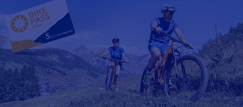
Start from the Mottolino Refuge: the trail can be reached by the cable car of the same name or from parking area P11 Somp Eira. Go up a short initial stretch of the bridleway then down to the Camane'l di Planon, a winter refuge on the ski slopes close to the TeolaPianoni Bassi chairlift. This is the world's first section of the Flow Country, designed by famous mountain biker Hans Rey. From here path N125 heads south of the forest, passing the Baite'l da la Ble's and Baite'l dal Moton da l'Al. The trail then descends into the Val delle Mine, reaches the dirt track at Chese'ira da li Mina and continues up to Alpe Mine Refuge where you can stop for a welldeserved break and delicious food in a unique natural environment. Using the Mottolino cable car for the ascent is an incentive for fans of mountain biking to experience this exciting and enjoyable single trail.

Details

Start
Start
Ristoro Mottolino

End
End
Ristoro Alpe Mine

Max. slope inclination
20%

Min. slope inclination
13%

Altitude difference
Altitude difference
259 m

Altitude difference
Altitude difference
459 m

Max altitude
Max altitude
2445 m

Min altitude
Min altitude
2126 m

Other paths

Trekking Tour

Mountain-bike Trekking excursion

Val da La Forcola

circle Closed
Start from parking area P14 Pont Lo'nch, then immediately take the bike trail on the righthand side towards Forcola. On the left is the small church of Tre'sgenda then the chapel of San Cristoforo. From Pont Re'z Sc'tort the trail becomes a dirt bridleway and, having crossed the Pont dal Ve'rt, it ...
Length
10 Km 16 m
Duration
01:16
Difficulty
Trekking excursion

La Colma

circle Closed
Starting from parking area P10 La Forcola, take path N151 towards La Co'lma, the entrance to the Val da Fain on Swiss territory. To get there you ascend a wellmaintained trail that crosses a steep ridge where care must be taken not to dislodge rocks onto the road below. Once at La Co'lma, near a ...
Length
11 Km 58 m
Duration
03:49
Difficulty
Mountain-bike E-Bike Trekking excursion

Le Sorgenti dellAdda da Livigno

circle Closed
The route departs from the Livigno Dairy P4 and runs flat on bridleway N138 along the right bank of the Lake of Livigno up to Pont da li Ca'bra and then up to the Alpasge'la refuge. From this point, in the territory of the Stelvio National Park, the trail becomes narrow and challenging, but no less ...
Length
8 Km 569 m
Duration
00:51
Difficulty
Trekking excursion

I lach da la Forcola

circle Closed
Starting from parking area P10 La Forcola, take path N151 towards La Co'lma, the entrance to the Val da Fain on Swiss territory. To get there you ascend a wellmaintained trail that crosses a steep ridge where care must be taken not to dislodge rocks onto the road below. Turn onto path N153 that ...
Length
3 Km 106 m
Duration
01:10
Difficulty
Trekking excursion

Al Filon

circle Closed
Start from parking area P6 La Tresge'nda: the first stretch is a paved bridleway up to Pont da l'Al. From here there is a dirt bridleway, path N119, that winds up through a forest of larch and fir trees, with numerous plant species described by information panels along the trail. The forest gives ...
Length
8 Km 696 m
Duration
04:27
Difficulty
Trekking excursion
Length
3 Km 498 m
Duration
01:05
Difficulty
Trekking excursion

Somp i Crap Neir Monte Breva

circle Closed
Starting from parking area P10 La Forcola, take path N151 towards La Co'lma, the entrance to the Val da Fain on Swiss territory. To get there you ascend a wellmaintained trail that crosses a steep ridge where care must be taken not to dislodge rocks onto the road below. Once at La Co'lma, near a ...
Length
6 Km 44 m
Duration
02:50
Difficulty
Trekking excursion

Bocheta Canton

circle Closed
Start from the parking space P2 Vie'ira take the stairs to cross the gallery of the Gallo road. Here take the path N176 which is in the prairies in the first part and then in a nice larch and pine forest. Going on, the natural scenery gets wilder. The possibility of seeing wild animals as chamois ...
Length
8 Km 628 m
Duration
03:56
Difficulty
Trekking excursion

Piza di Rin

circle Closed
Start at the parking P3 Calche'ira direction Camposc'tin to take the path N174 to the Te'a Alta da Fedaria and reach the prairie I Paris. Great view from here on the valley. The path becomes more and more challenging, make sure to go on the path N174.1 on the left site to get to the Pi'za di Rin ...
Length
5 Km 681 m
Duration
04:08
Difficulty
Trekking excursion Mountain-bike

Passo Foscagno

circle Closed
The path leaves from parking area P12 Pont de Rez in Trepalle then goes along the western side on a path that leads to the bridge connecting the village of Campacc to Arne'ira. From here, take path N129 on the righthand side of the filling station, on a path that runs alongside the Foscagno road ...
Length
4 Km 479 m
Duration
00:31
Difficulty